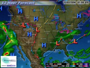
The Arctic airmass that has settled across DFW and the rest of North Texas on Monday will begin to erode, as the Arctic high slides east and a rather intense warm air advection pattern begins. Our winds will become south/southwesterly today and back more south/southeasterly tonight. This will allow warmer air to begin overriding the colder air at the surface. Well after midnight tonight, areas of fog and drizzle will begin to develop across the forecast area. Some of the fog could be rather dense at times with visibilities below 1 mile. The fog and drizzle will be very slow to burn off on Wednesday and will hang in for much of the morning. Given the pattern, we will keep low chances of light rain showers in the forecast through Friday. Temperatures will begin to warm to near normal, or slightly above, (60s/70s) as we head into the middle and latter part of the week.
By Friday, rain chances will increase as a shortwave approaches (courtesy of weakening upper low moving ashore off the California and Oregon coast) in conjunction with a cold front from the north. Widespread rain will be possible with isolated thunder as dynamics increase ahead of this system. The cold front is expected to move across Friday evening with a combination of Pacific and Canadian air. This front will not be nearly as strong as the Arctic front that moved through early Monday morning. However, it will keep temperatures below normal heading into early next week as another stronger disturbance and cold front arrives. This will bring additional rain chances to the region as we head into next week.

